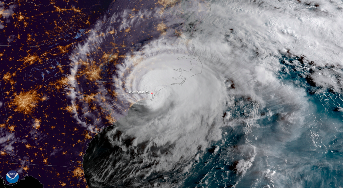
Hurricane Florence made landfall as a Category 1 hurricane Friday morning in Wrightsville Beach, North Carolina, just east of the city of Wilmington. The storm has been significantly downgraded from a Category 4, to the relief of many residents.
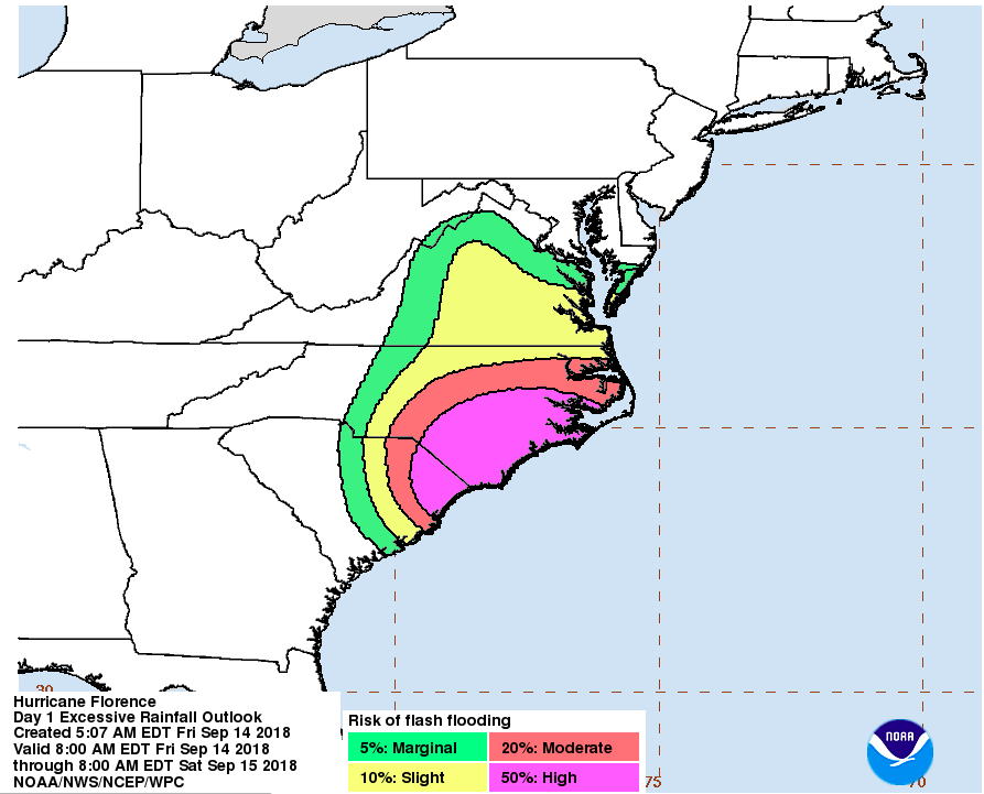
But Florence’s real danger lies in its rains and storm surges — which are now imperiling millions of people along the southeastern United States.
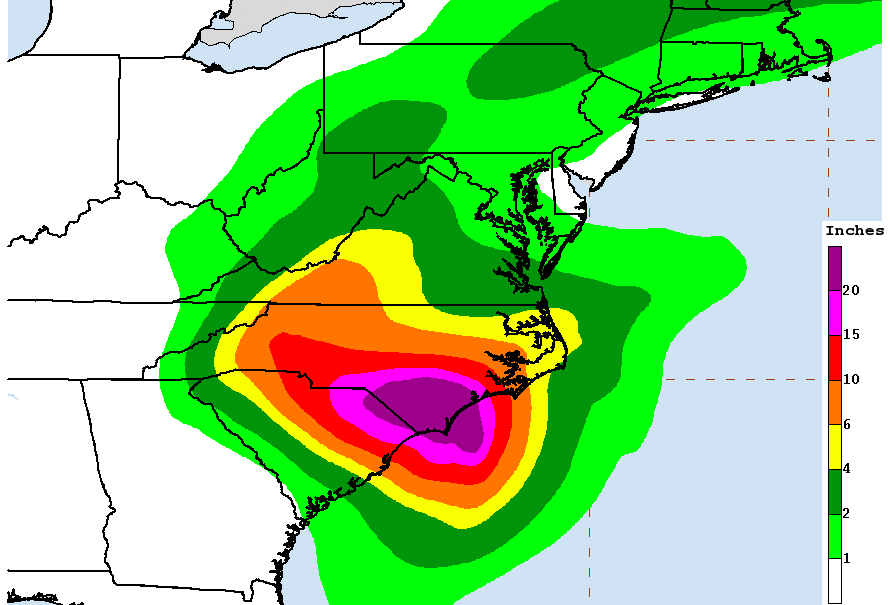
Some estimates place the current rainfall associated with Florence at around 10 to 20 inches of rain, a staggering amount in such a short period of time. The Southeast Regional Climate Center (SERCC) tweeted Friday that a record 30 inches of rain appeared to have been recorded according to a U.S. Geological Survey (USGS) Station in Atlantic Beach, but those numbers still need to be confirmed. (Officials have estimated some remote areas of the state could ultimately see 40 inches of rain.)
All data collected during a natural disaster like Florence is preliminary and not to be relied upon for official numbers until it has undergone a quality control process. Consensus among forecasters maintains, however, that the region is in for a torrential amount of rain, with life-threatening ramifications.
“Although Florence had become a Category 1 hurricane on the Saffir-Simpson wind scale, it remained a Category 5 heavy rain and inland flooding threat, and a Category 3 storm surge threat,” commercial weather service Weather Underground described on Thursday night, laying out one way to think about the storm.

Intense rainfall and higher storm surges — as are expected with Hurricane Florence — are being made worse due to climate change; warmer waters make the storm stronger and wetter, while higher sea levels mean storm surges will be bigger and move farther inland.
In fact, a study released in advance of Florence making landfall estimated that warmer waters will supercharge the hurricane, causing 50 percent more rain to fall than it would have otherwise.
Prior to the storm’s arrival, some coastal areas were already documenting flooding. And collapsed roofs and encroaching water were being reported in parts of North Carolina early Friday morning, with around 150 people awaiting rescue in the city of New Bern.
“We have 2 out-of-state FEMA teams here for swift water rescue. More are on the way to help us. WE ARE COMING TO GET YOU,” a Twitter account for the city wrote at 2:27 am. “You may need to move up to the second story, or to your attic, but WE ARE COMING TO GET YOU.”
Greeted with a 105 mph wind gust on Friday, the strongest to hit Wilmington since 1958, officials in the city wasted no time in emphasizing Florence’s dangers.
“I see a biblical proportion flood event that’s going to occur,” said Wilmington Police Chief Ralph Evangelous to ABC News. “I see the beach communities being inundated with water and destruction that will be pretty, pretty epic in nature.”
Around 455,000 North Carolina customers had lost power by late Friday morning. Major storm surges are also expected, with some areas set to possibly see surges as high as 11 feet. Some areas have already reported surges of more than 9 feet.
The storm’s center may linger for another day along the coast, allowing for even more damage, as area rivers remain under intensive monitoring for potential flooding.

At least one meteorologist has predicted Florence could dump 10 trillion gallons of rain into next week — enough to fill roughly 15 million Olympic-sized swimming pools, according to CNN.
While mandatory evacuation notices were issued along the coast, many people chose to stay behind for a variety of reasons, including finances and concerns over moving ill or frail family members. Good samaritans in the area have reportedly taken out boats in an attempt to help those trapped and awaiting rescue, but officials are advising all residents to go to higher ground until they can be evacuated.
Even in areas far to the west, like Buncombe County where the city of Asheville is located, officials declared a state of emergency, with as many as 10 inches of rain projected for the area.
A storm like Florence is highly unusual, but is growing more common due to rising global temperatures. Climate change is warming ocean waters and allowing hurricanes to form rapidly and become supercharged. Hurricanes are also becoming slower — stalling over the coastline and unleashing a torrent of rain for days on end.
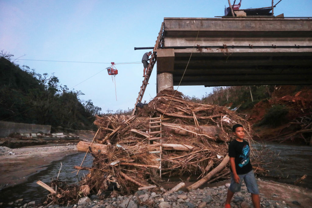
That nightmare scenario played out last fall, when Hurricane Harvey made landfall in southeastern Texas. The Category 4 hurricane’s speed and winds did damage, but the storm’s rains ultimately wrought more havoc on the region, drenching the sprawling city of Houston and destroying homes for miles around. A year later, many people have been unable to return to their homes and the region has been fundamentally changed.

Forecasters worry that same disaster could play out with Florence, whose rains have maintained power even as its speed has slowed.
With the worst of the storm’s damage far from over, officials and weather experts are emphasizing the need for safety and preparation. On Friday morning, the National Weather Service cautioned residents to prepare for a prolonged onslaught.
“This storm will be a marathon vs. a sprint,” the agency observed grimly.

