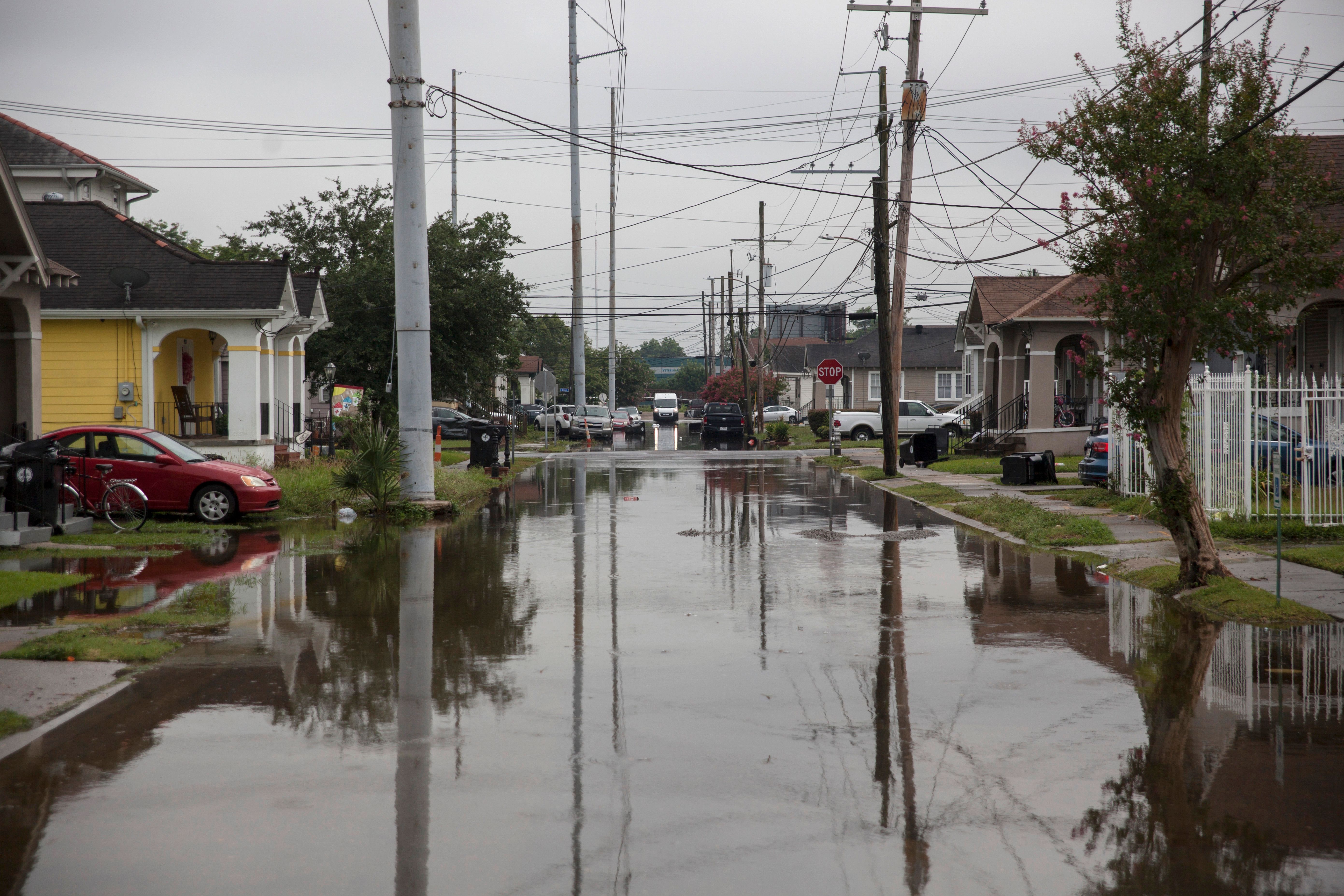
Parts of the South, including much of Louisiana, are bracing for potential catastrophic levels of rain this weekend as Tropical Storm Barry draws near.
The National Hurricane Center (NHC) said the storm could strengthen to hurricane levels by Friday night or Saturday morning. But experts cautioned on Friday that the real danger associated with Barry is from the rains the storm will bring: A torrential downpour is set to fall on an area already saturated with water.
“If they push it high enough, it’ll overtop the levees,” Darryl Malek-Wiley, an environmental justice organizer in New Orleans, told ThinkProgress in advance of the storm.
Barry is expected to make landfall on Saturday, bringing between 10 and 20 inches of rain to the region.
“It’s a problem if it’s this slow,” NHC director Ken Graham said. While hurricanes typically are seen as being more severe than tropical storms because of their wind strength, Graham underscored that precipitation will be the real danger with Barry. “Ninety percent of fatalities of tropical systems historically have been [from] the water,” he said.
The most prolific threat with #Barry will come from significant and life-threatening flooding across southeast Louisiana. Notice from this PWAT loop how Barry slows to a crawl for several hours just after making landfall in southern Louisiana. pic.twitter.com/dZ63UAkQTI
— John Kassell (@JPKassell) July 12, 2019
Louisiana declared a state of emergency in advance of the storm, and around 10,000 people have been ordered to evacuate, including many from areas near New Orleans. The city itself is preparing for potentially deadly flooding, almost 15 years after Hurricane Katrina devastated the region.
Billions of dollars have gone into upgrading the New Orleans levees and other security mechanisms to prevent against flooding, leaving the city better-prepared than it was more than a decade ago. But potentially devastating rains from Barry remain a cause for concern.
“Flooding is expected to be the most significant threat,” the New Orleans branch of the National Weather Service (NWS) warned Friday, as the storm turned toward the northwest, on a path that now includes much of Louisiana.
Other southern states were also preparing for the advance of the storm. The NWS chapter based in Mobile, Alabama, advised residents to store “any critical documents in a waterproof container or electronically” and to keep a disaster supply kit nearby, with parts of Mississippi also planning accordingly.
Forecasters in Texas remained optimistic that the storm would largely spare areas like Houston, which saw staggering amounts of deadly rain during Hurricane Harvey in 2017. But they cautioned on Friday that the path of the storm could still change, with severe implications for the Texas coast. The western Florida Panhandle is also preparing.
But for Louisiana, the forecast is more grim. The region has already experienced extreme levels of rainfall associated with massive flooding in the Midwest and South earlier this spring. Data released in June by NASA’s Earth Observatory showed that the continental United States just experienced its wettest 12 months on record, part of a growing trend scientists associate with climate change.
That uptick in water has left the Mississippi River at usually high levels — in New Orleans, the river’s levels are only four feet below the city’s levees, leaving open the chance for overflow as Barry’s rains arrive. Most of the levees protect against up to 20 feet of water, but current projections show that the river could crest at that level due to the storm. Water levels in the city were at only three feet when Katrina hit New Orleans in 2005; they are currently at 16 feet.
Whether Barry strengthens to a hurricane or not, the storm follows a pattern noted by climate scientists. Warming ocean temperatures allow major storms to move slowly and then stall over land, unleashing a torrential downpour before breaking apart. In 2018, Hurricane Florence made landfall with Category 1-level winds, but the storm’s catastrophic rains left the Carolinas and other parts of the Southeast completely inundated. Harvey similarly drenched Houston and the Texas coast the year prior.
That could be a “worst-case scenario” for places like New Orleans, which saw major flooding earlier this week as up to nine inches of rain fell on the city. Neighborhoods like the Lower Ninth Ward are still recovering from both Katrina and Hurricane Rita. Malek-Wiley expressed concern about those communities, even as he underscored preparation measures.
“Everyone is doing things, making sure they’ve got food, water, the standards things,” he said, noting that he has been advising residents to take further precautions, heading to the upper levels of buildings, if possible, and moving their belongings away from ground level.
The Army Corps of Engineers insists that the city’s levees will hold. But Louisiana Gov. John Bel Edwards (D) stressed during a Thursday briefing that much depends on rapidly rising water levels.
“I want everyone to understand this this was never going to be a wind event; it was always going to be a rain event,” he said.

